Key Findings
Key Findings from MCSMIP-DYAMOND
We comprehensively evaluate tropical mesoscale convective system (MCS) characteristics in the DYAMOND (Stevens et al. 2019) global km-scale model simulations for both summer and winter phases. Using ten different feature trackers applied to simulations and satellite observations, we assess MCS frequency, precipitation, and other key characteristics.
1. MCS Characteristics from Participated Trackers
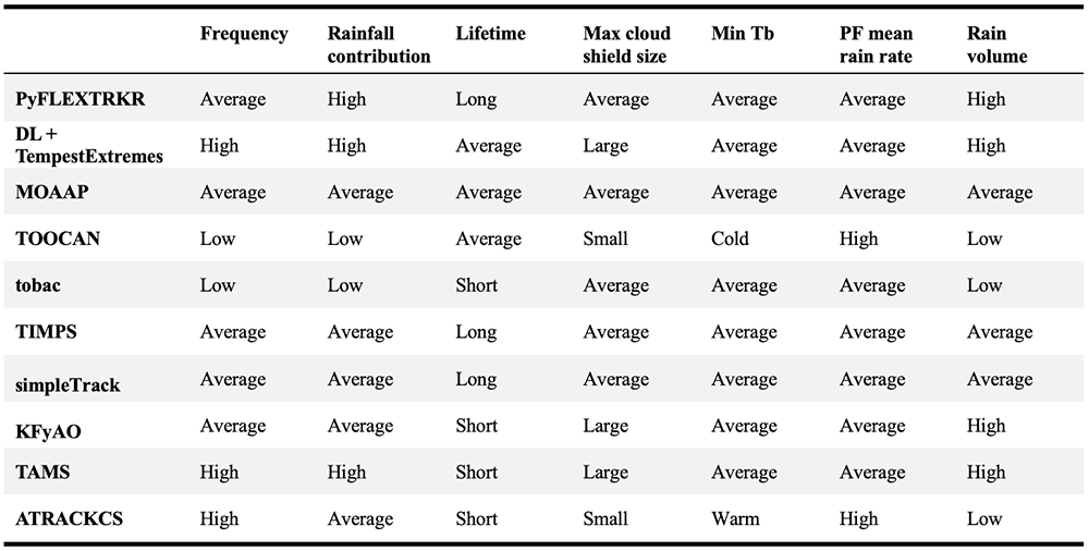
Table 1 summarizes the MCS characteristics derived from each tracker relative to the average characteristics across the tracker ensemble based on observations. Rather than providing a ranking, the table illustrates how the behavior of each tracker compares to others, as no reference tracking dataset on the global scale exists for the study period to quantitatively validate the derived MCS characteristics. Future research using any of the trackers examined in this study should carefully consider the behavior of their selected tracker, particularly when comparing results across studies, as differences between trackers may significantly influence outcomes.
2. MCS Frequency and Precipitation Amount Biases
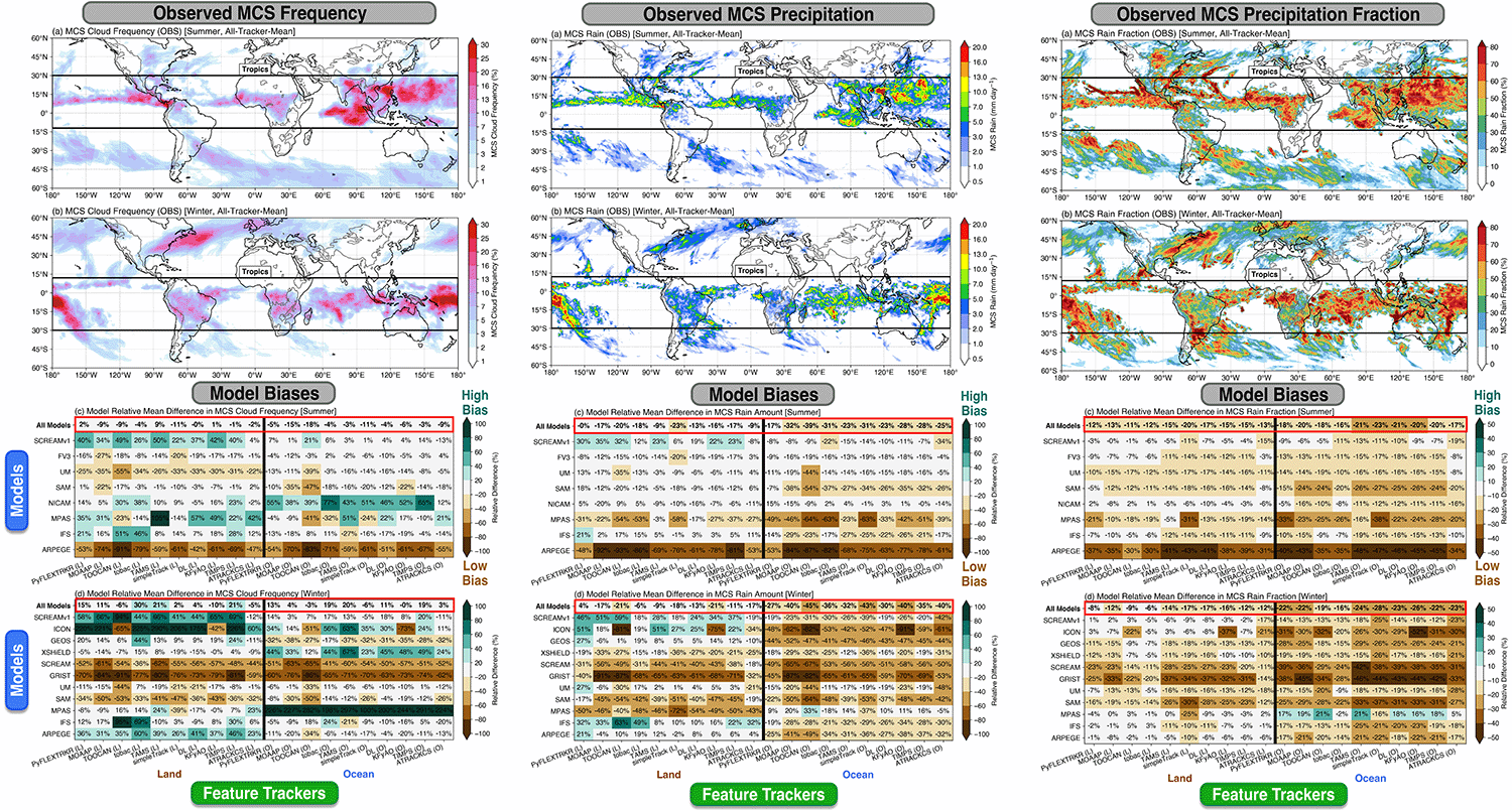
Despite substantial differences (a factor of 2-3) in observed MCS frequency and their precipitation contribution among the trackers, model-observation differences in MCS statistics are more consistent across the tracker ensemble.
Models are generally skillful in simulating tropical mean MCS frequency, with mean biases of -2% to 8% over land and -8% to 8% over ocean (summer vs. winter), though large variability exists among the models (Figure 1 left column). Most models underestimate MCS precipitation amount (-14% over land, -28% to -37% over ocean, Figure 1 middle column) and their contribution to total precipitation (Figure 1 right column), with smaller multi-model mean biases over land (-13%) than over ocean (-21%). The smaller bias over land may be related to the stronger diurnal cycle that drives MCS development compared to that over the ocean.
3. MCS Characteristics
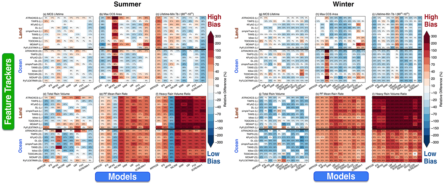
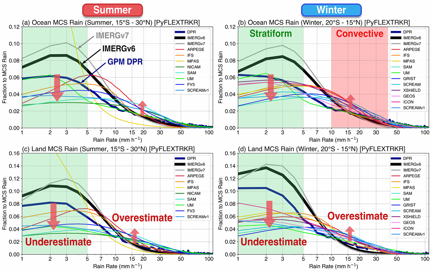
MCS cloud shield characteristics are better simulated than precipitation (Figure 2). Most models overestimate MCS mean precipitation intensity (by a factor of 2-3) and underestimate stratiform rain contribution (up to a factor of 2), particularly over land (Figure 3).
4. Moisture Evolution Associated with MCSs
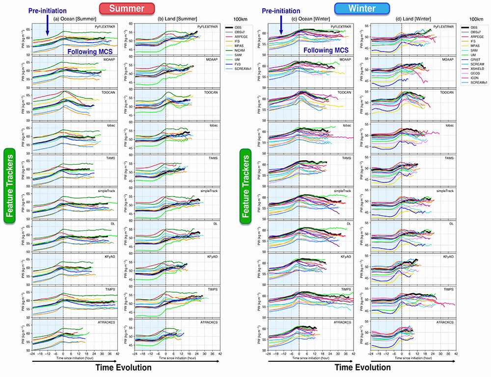
Models capture the environmental moistening rate leading up to MCS initiation both over ocean and land, but a large inter-model spread in the magnitude of PW is found (Figure 4).
5. MCS Precipitation Intensity Biases
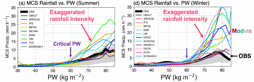
Most models simulate the exponential increase of MCS precipitation intensity beyond the critical PW value over ocean, although the MCS precipitation sensitivity to PW is overestimated (by a factor of 2-3) in most models (Figure 5).
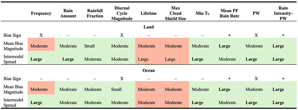
6. Summary of DYAMOND Model Biases